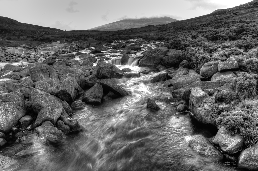
* Wicklow Gap * upwards
I
R
L
In southern Wicklow Mountains National Park, between Tonelagee and Turlough Hill leads the R756 to Glendalough.
This area is moory and spring for (first of all) two small rivers: King River and Glendalough
.
.
this picture is taken 2 km below Wicklow Gap, Glendalough River
.
handsfree - HDR from 2, made to B&W and smaller - for fc ....
.
.
.
other side, downwards: 
* Wicklow Gap * - downwards
BGW-photo
so sorry, google.maps doesn't provide exact data for this spot, but there it is:
http://maps.google.de/maps?q=53.024561,-6.363101&ll=53.023896,-6.361095&spn=0.004917,0.009645&num=1&t=h&z=17
for our fans of Irish Music: http://www.wicklowtrad.com/
Ireland 2012


Joachim Irelandeddie 27/10/2015 14:52
Eine sehr gute s/w-Aufnahme hast du hier gemacht! Sieht sehr schön aus so als Langzeitbelichtung! Die Wicklow-Mountains sind herrlich, da hat es uns auch immer sehr gut gefallen!lg eddie
BRYAN CRUTE 23/11/2013 17:02
Looks as impressive in B&WRegards
Bryan
jah.picture Photography 06/09/2013 19:20
sehr gut!photograf 02 13/10/2012 12:33
ganz stark in dieser s/ bearbeitung...aber auch sehr schön aufgenommen vorher
lg
ha-jü
Jakob F. 02/10/2012 9:48
Ach ja, in den Wicklow Mountains war ich auch schon mal, da kommen schöne Erinnerungen hoch ...VG Jakob
Cobrak 29/09/2012 2:27
Bellissima..!Roland Krinner 29/09/2012 0:21
Long Exposure in s/w mag ich mittlerweile auch sehr gern. Es soll im nächsten Jahr auch Irland gehen ;-)Freu mich schon
LG
BGW-photo 28/09/2012 23:17
ich danke Euch ganz herzlich für die Kommentare!@ Kurt: ruhiges Hocken auf'm dicken Stein - und die Kamera auf den Knien geht auch für 3 Bilder ;-)
@ Jürgen: macht nichts, Schuhe vorher ausziehen ;-)
@ Volker & Venta: cordially thanks! exactly that was my feeling, as the water flowed towards me ...
Bernd
Jürgen Leuffen 28/09/2012 21:39
geiles Pic Bernd-ich hoffe du hattest keine nassen Füßegr Jürgen
kwolf191 28/09/2012 20:34
Coole Aufnahme ! Wunderschön die Bewegung des Wassers, man kann gar nicht wegsehen..! Und handsfree - Deine Ruhe hätte ich gern ! lg Kurtdreamer 07 28/09/2012 20:02
wunderschön,Chapeau**LG dreamer
KHMFotografie 28/09/2012 19:46
.... eine starke Landschaftsaufnahme, bernd..... und in SW..... kommt das super rüber+++++LG. kalle